Chatsworth Road, Millfields, and the River Lea

Sunday, 6 September, 2020

My friend was having a birthday party. Such things right now worry me quite a lot. How do I balance my worries of being around other people with my desire to celebrate with a dear friend? It would be outside in a pub garden, I was assured, but still I hesitated. For one thing (and in a major way) she lives in an area that’s recording the second highest rates of infection in the borough. All the guidance says that this population needs to stay away from others. How foolhardy would I be to say yes? How awful would I feel if I said no? I compromised by saying I’d be happy to drop by for an hour as long as it was outside and then I determined not to get too close to anyone.

One way I’m able to soothe the fear and worry is think about how I can make the best of an outing. Invariably, this means taking photographs and thinking ahead to what I might be able to do while out – maximising the effort. I’m not sure if this is sound thinking but it will do. For me, at least.

Bus route pink, Walking route yellow

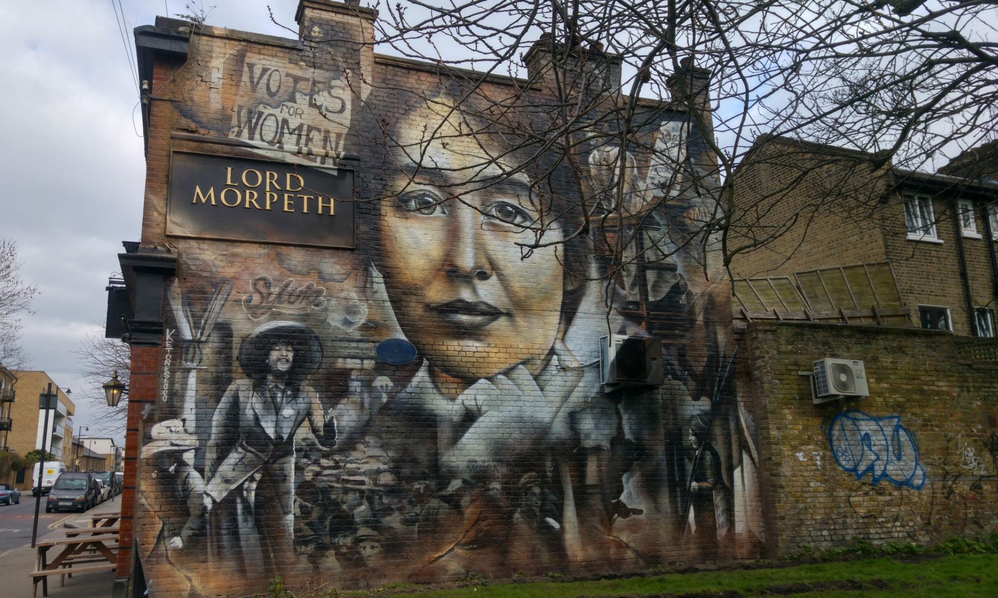
Part of my compromise with myself was to walk through Chatsworth Sunday  market to see how it was faring right now. I do love the street, and the market can be colourful and interesting. There’s a little deli that might have something interesting to take home with me, too.

The bus sped along Homerton High Street without stopping in at the hospital. I’d forgotten about the construction on Homerton Row. This just meant more walking to retrace the route to go up Chatsworth Road. Not so bad. It was a lovely day and that helped.

The market was underway, smaller than usual. Most disappointingly, like most other East End markets, the food stalls and trucks have taken over. There’s little else going on. I love looking at the food offers but it’s honestly feeling a little tedious by now. Perhaps if the quality were to improve or the prices were to go lower (I’m happy with small dishes to compensate for this) I’d feel better. It’s like the let down feeling when someone you’ve discovered some time ago goes mainstream and loses it appeal as it changes or sometimes degrades. Or perhaps I’m just a snob.

Posher flats on Homerton High Street
Posher flats at Homerton High Street. Just across the road is a broken down and boarded-up housing estate (next)
Boarded up
Boarded up
Chatsworth Road barricading in place
Approaching the market on Chatsworth Road

A note about Percy Ingles Bakers. A sad one. The bakery was founded in East London in 1954, by Percy Ingle. His grandsons were running it until they announced they were closing up. I grew up with this bakery, on the Roman Road at the top of the market. As a child, there was nothing better than the luridly pink iced buns, the chocolate cornflake cakes, the lovely slabs of bread pudding, and the many hot meat and other pies I so often grabbed more recently when hungry for a quick lunch while out. It turns out that the very first Percy Ingles bakery was on Clarence Road! There hasn’t been one there for a long time but there was one at the top of the Narrow Way, close to Clarence Road. The store on Chatsworth Road shows its rebranding to just Ingles, its new colours making it look more modern and stylish. In the end, it didn’t matter. Covid-19 was the final straw.

A pretty fancy but doomed Percy Ingles

Food food food at Chatsworth Road Market

L'Epicerie, a nice little deli
L’Epicerie, a nice little deli, especially lovely at Christmas
A sight I'd never see in Toronto!
A sight I’d never see in Toronto! Take Away cocktails
A lone plant stall amongst the food offerings
A lone plant stall amongst the food offerings. Not much colour today

Continue reading “Chatsworth Road, Millfields, and the River Lea”

Short walks in Clapton and Stoke Newington

Saturday, 30 August, 2020

Short walks are the thing! I had a couple of places I wanted to see this week, and I have been slowly crossing things off my list. On Thursday I went to look more closely at the old Orphan Asylum and on Friday I decided to have a return visit to the Stoke Newington Farmers Market. So how did I do?

One thing I wanted to do is go back to Clapton Square and take in Clapton Passage. For one thing, at the Clapton Square end, there’s a gorgeous Loddiges palm tree. I like the narrowness of the passage but the houses aren’t in good repair.

The last time I walked on Clarence Road, I was alone and a little too nervous to wander down Clarence Mews alone so Krish and I went into the mews and I could dream about my sometime mews house again.

Two mews houses
Two mews houses
Peering in a window in the mews
I peered in a window at the long space. Most of these houses are the homes of artists, craftspeople, and architects
In the mews
In the mews
Impressive home on Clapton Passage
Impressive home on Clapton Passage, at the exit from Clapton Square
That beautiful palm at the corner
That beautiful palm at the corner of Clapton Square and Clapton Passage
Clapton Passage
Clapton Passage
Side door, St John's Mansions on Clapton Passage
Side door, St John’s Mansions on Clapton Passage with its dormer windows

From Lower Clapton Road, the old Orphan Asylum looks really  impressive. The first time we saw it, we wondered what it was. It stands there like a Hackney Acropolis.


See what I mean? A sort of Hackney surprise, one of many. It’s a shadow of its former self, though.

From my research: The London Orphan Asylum was founded in 1813 by Andrew Reed who had been trained at Hackney College. The site of Hackney school off Lower Clapton Road, later reached by Linscott Road, was bought in 1820 and the children were transferred to new buildings there in 1825. The asylum included boys’ and girls’ schools and was administered by the headmaster, who was also chaplain; numbers rose from 206 in 1826 to 453 in the 1860s. The building by W. S. Inman, ‘very ambitious although rather cheaply executed’, had a frontage of 19 bays, the central 3 projecting beneath a pedimented Tuscan portico and the outer ones also projecting; it was extended behind in 1846 and included a chapel seating 400 in 1851.  After the orphans had moved to Watford in 1871, the building was taken over by the Metropolitan Asylums Board c. 1873-6 and the Salvation Army from 1882.

There’s still a school there. We took some photos and a man came to ask if he could help. Oops. There were no children around so I hope no one will come after me. This was a small street with some cute kids’ art.

And that was that. I’d finally had a close-up look at the asylum. I was shocked to see no plaque on there, no sign of what it once was. Just a shell with no life. I’d like to check the archives for pictures of the children, the school and boarding rooms, and the site as it once was.

And then Krish couldn’t resist some chips from The Mermaid fish bar at Clapton Pond, another area I must blog about when I can.

The usual massive pile of chips

As we walked home, we came across a memorial. I don’t know if this man was an accident or murder victim, but I shudder when I see these. There was a time that Hackney had a reputation for violent crime. This has changed over the years, but I think that the pandemic has brought out some bad feelings and actions. I hear it from everywhere. Around here we sometimes have gang fights and random violence on the housing estates. I hear the helicopters circling and I’m never sure if there’s a rave somewhere or the police are on the lookout. It’s not restricted to Hackney but this is my neighbourhood so it’s meaningful.

Trickcy, it reads

Trickcy
Trickcy, I think. Son, Brother, Father, Friend, it read

Continue reading “Short walks in Clapton and Stoke Newington”

A walk to Ridley Road Market

Friday, 28 August, 2020

On a day when I thought staying home and resting might be a good idea I instead found myself saying yes to going up to ‘the big Sainsburys’ in Dalston. It was an excuse to take a couple of photos for my aunt of a converted synagogue nearby and also keep my promise to myself to take some photos in Ridley Road Market.

First off, the synagogue. It’s hidden behind Montague Road. Montague Road Beth Hamedrash began 1902 and closed between 1980 and 1985. I’ve often thought about living in that top floor with the patio balcony.


There are many repurposed and demolished synagogues around. It amazes me how many there must have been at one point. My research tells me that around 1880 there were about 5,000 Jews in Hackney and Dalston. The richer Jews tended to move further north to Stamford Hill, Highbury, and Stoke Newington. By the end of the early 1900s there was a large population of the ‘better class of Jewish working man.’ The Jews of Whitechapel chose Dalston or Canonbury as their ‘first steps upwards.’ In the early 1950s Hackney was assumed to have the densest Jewish population in the country,  and the two estates on Amhurst Road alone contained 1,500 to 2,000 working-class Jews, while half of the boys at Hackney Downs school were Jewish. Many of these families prospered and moved along and less than a third of the school’s boys were Jewish by 1972, replaced by newer Afro-Caribbean immigrants. My closest synagogue is about a kilometre away today. The Montague Road Beth Hamedrash would have been a two-minute walk, with others to choose from not much further. 

Little house between two larger
I always think about how I could live in one of these little houses built between two larger ones
St Marks
Another view of St Marks Church on my way to Ridley Road

Straight up to St Mark’s Rise and turn left and the bottom of Ridley Road market is straight ahead. I wasn’t keen to go into, with all the restrictions. There are barriers on either side too and that’s a bit daunting, since I often want to leave to get out to the shops along the road. Instead I walked along the west side of the market, taking in the sights of the mostly Afro-Caribbean storefronts.

The shops are mostly just shallow sheds along the road, each with its chaotic assortment of goods. There’s fish, meat, fabrics, vegetables and fruit, and household goods.

I’m not the first to say that there’s not enough Ridley Road history. Geographically, it links Dalston Lane to Kingsland Road but there’s really nothing much said about the street until the mid 1800s. The main street of Dalston, Kingsland Road, was completely commercial  by 1849, properties being sold off by the Tyssen family, and the tram arriving in 1872. In 1930 The Kingsland Road market was in Ridley Road, and was among the best known in London. Other records show that the market existed since the 1880s. This period features in most of the then-modern Hackney, with so many houses that I’ve photographed having this decade engraved on the facade. Ridley Road at the end of the 1880s had about 20 stalls and has played an important part in Hackney’s history. Before the pandemic is had over 150 stalls. Once a Jewish market, it is now mainly Afro-Caribbean and Turkish.

Restricted entrance to the stalls area
Restricted entrance to the stalls area of Ridley Road Market. Normally, stalls would come right down the end down either side of the road
The fabric store at the bottom of the market
The fabric store at the bottom of the market has seen better days. I’ve shopped in there, hoping the mountain of fabrics wouldn’t engulf me
A jumble of dry goods
A jumble of dry goods and shoes
Random Afro-Caribbean goods
One of many butchers
Clothing in the central market
Stalls are spaced apart
Stalls are spaced apart and there are fewer than there once were
Obligatory burger and hot dog stand
Obligatory burger and hot dog stand. On the whole they are very poor quality
Lots of plantain
Lots of plantain
Near the top of Ridley Road
Near the top of Ridley Road, with Kingsland High Street and the new buildings ahead
New normal spacing
New normal spacing means the stalls are sparse
The top of the market
I reached the top of the market and stallholders were starting to leave

It’s hard to show the atmosphere of Ridley Road so I took a couple of videos to try to show it. This is pandemic time so it doesn’t bustle as it used to.

I’ll confess to not liking to shop on Ridley Road, and I’ll often avoid walking along it. While it’s interesting, it crosses the line of interesting into too scruffy. That’s saying a lot coming from me. I don’t see the sense of pride I think there should be there. The shops stay the same, often look dirty, are usually quite smelly…have I sold you yet? However, there’s a lot of colour and vibrancy once you get past the assault on your senses. And you’ll find the odd favourite stall – the egg stall, and the one where we buy herbs aren’t there right now but we went regularly.

With so many newcomers in the area demanding more modern, luxurious surroundings, and with the increase in new building, Ridley Road is threatened. New residents aren’t shopping here, the poorer shoppers are being squeezed out of the area by rising prices, and the stallholders are having trouble meeting the rents and rates along with the decrease in traffic. The pandemic has has meant fewer stalls, so restricted foot traffic and revenue. While I am not a big Ridley Road fan, I’d be sad to see it totally cleaned up and overhauled, if not razed. No matter what, Ridley Road has served this community very well for almost a century and a half and I don’t know what Dalston would be without it.

The different sides of Whitechapel

Monday, 31 August, 2020

We wanted to walk around Whitechapel again. The area is very dense and has some heavy contrasts. Here I’ll give a warning: There are many, many photos and I did this walk two weeks ago. I no longer remember where each part belongs or what I was thinking about when I took the photos. I may have to juggle things about but I know I won’t get it completely right.

What matters, though, is that our walk took us through the older areas of Spitalfields, through some parts of Whitechapel that my grandparents – and even my parents – would have a hard time believing, and into some areas where the stark, modern lines struck a strong contrast with the old, sometimes converted, warehouses and factories.

To me, it was a typical Whitechapel adventure, where anything was possible, where the past and present cooperate and compete, and where the future can only be imagined. There’s a little bit of history, but not too much or my brain will hurt, and as much everyday thinking as I can muster along the way.

Map of Whitechapel walk
A wildly inaccurate map of where we walked
Our first overground train ride
We hadn’t taken the Overground since lockdown. The new trains were operating, the carriages were quiet and masks weren’t always apparent. It’s less than ten minutes from Hackney Downs to Liverpool Street Station

Keeping a safe distance and staying where you need to be
Keeping a safe distance and staying where you need to be, at Liverpool Street Station
It's rare to see Liverpool Street Station so quiet on a weekday
It’s rare to see Liverpool Street Station so quiet on a weekday
1682
Venturing into Spitalfields. The building sign says 1682. It’s Ottolenghi at Artillery Passage and it had been closed temporarily for weeks

From Middlesex Street, the old and the new
From Middlesex Street, the old and the new. Middlesex Street is the main road for Petticoat Lane
Paste ups as always
I didn’t photograph street art on this walk.This is an oldie but goodie


Toynbee Hall
Toynbee Hall, built in 1886 to serve the poor of London’s East End
The Old Streets of Tenter Ground
The Old Streets of Tenter Ground. Built by the Flemish weavers, the Huguenots who fled Belgium in the 17th century. Here, newly woven cloth was stretched taut to flatten on an open field. When the Huguenots left, housing was developed in 1829 and the Dutch Jews (The Chut) moved into the area

The Soup Kitchen for the Jewish Poor, Brune Street
The Soup Kitchen for the Jewish Poor, Brune Street, (5662 -1902)
Brune Street Estate
London County Council Holland estate built between 1927–1936.
Houses where some of my ancestors lived are now finally gone
Houses where some of my ancestors lived are now finally gone. They were appallingly decrepit for years, a real eyesore. Now they’re gone, I feel quite sad

Finally, we got to Whitechapel High Street, at Aldgate East Station. The scenery changes dramatically.


Continue reading “The different sides of Whitechapel”

Odds and ends and reflections on blogging – Well Street

Saturday, 29 August, 2020

I’ve been reading other people’s blogs, You know, the ones everybody reads…and I’ve been surprised at how many public-facing people, even celebrities, are confessing to feeling desperate or depressed. I like this pouring out of souls. It’s not just that I feel less alone and hopeless, but that I feel a connection with myself.

I’ve been blogging quite a bit lately, after a fairly long silence. I think it’s because of this connection with myself and my environment. It’s because I felt that, rather than feel imprisoned, I would reach outwards to what is achievable, and then inwards to what I can bring to it. I told Krish last week that I spent one to two hours going on walks to find local things, but that blogging about it afterwards took three or four hours. It enhances my experience. He asked me if this meant that I needed to walk in order to do my blog. I think he was getting at me walking more. No, it’s not that. It is what it is. I can blog about anything. The walking is a means to an end and, as an agoraphobic, that’s important. Walking for the sake of walking is more difficult. The goal of photographing, researching onsite and off, writing later – all of these motivate me. And lately, lethargy and inertia are always threatening to pull me in.

Researching isn’t easy for me. I am impatient. I gather the facts and they overwhelm me. What to choose, what to leave out, and essentially for me, how to write it so that it’s friendly and easily understood. It’d be easy to not bother embroidering my writing about things, places, and people without any background information. Going on guided tours has taught me that knowing a little can enhance. Sitting on my couch right now, thinking about this house, I’d love to know who lived here before, who lived here first – who were they, what were they like, why were they here, what did they do, who was the first…? Krish says that doesn’t matter to him. I’m not sure he means it.

So I have a few blogs in hand. There are bits and pieces of things. There are photos that were left over, areas that weren’t quite completed, photos that belong to little walks that aren’t worth a whole blog. Then there are things around the flat that would be good to talk about. Add all of these to my To Do lists and there’s plenty to keep me occupied, if not delighted.

So here’s a start – Well Street.

Home and Well Street
It doesn’t look very far but it takes a while to get to Well Street
The Well Street walk
The route along Well Street starting at the top right. The Street is a long meandering one but we took a back road this time

On the day we went to Fassett Square and the German Hospital, we took a bus on Graham Road over to Well Street. Originally we were going just to Lidl for some oil and chocolate but Krish decided – unsurprisingly, that he couldn’t resist some cod bites at Well Street Fish and Chips.

On Graham Road on the way to Well Street

Well Street is a meandering road with one end at Morning Lane and the other on Mare Street – a good curve. We started at the point where it turns down into a small high street towards Morning Lane.

Well Street is in South Hackney, just  4.2 miles (6.8 km) northeast of Trafalgar Square (the recognised milestone of London when marking distance). There are records from the 1400s but nothing about a well, although the words like Water and Shore feature even today. Well Street also had a moated ‘Pilgrim’s House.’ There was a small settlement at first, and with a poorer population from the 1700s. By 1831 the whole of Well Street had houses and was quite prosperous, wth shopping and light industry including rope-making, boot-making, and leather working. A cinema arrived in 1913, the South Hackney Picture Palace, and by 1932 there were two housing estate, with two more following after WW2. Well Street has had many prominent residents and characters – Celia Fiennes the traveller and diarist in the 18th century (yes, she is an ancestor of Ralph Fiennes), and Jack Cohen the founder of Tesco who started off trading in Well Street Market. Continue reading “Odds and ends and reflections on blogging – Well Street”