Thursday, 30 July 2020
I have a plan to take little corners of the local area and explore them with my camera. They aren’t likely to be things or places I’ve never blogged about before, but this is my exploration radius now.
Yesterday I was meeting two friends outside in Dalston, so I gathered a list of things I needed to do and buy and off I went.

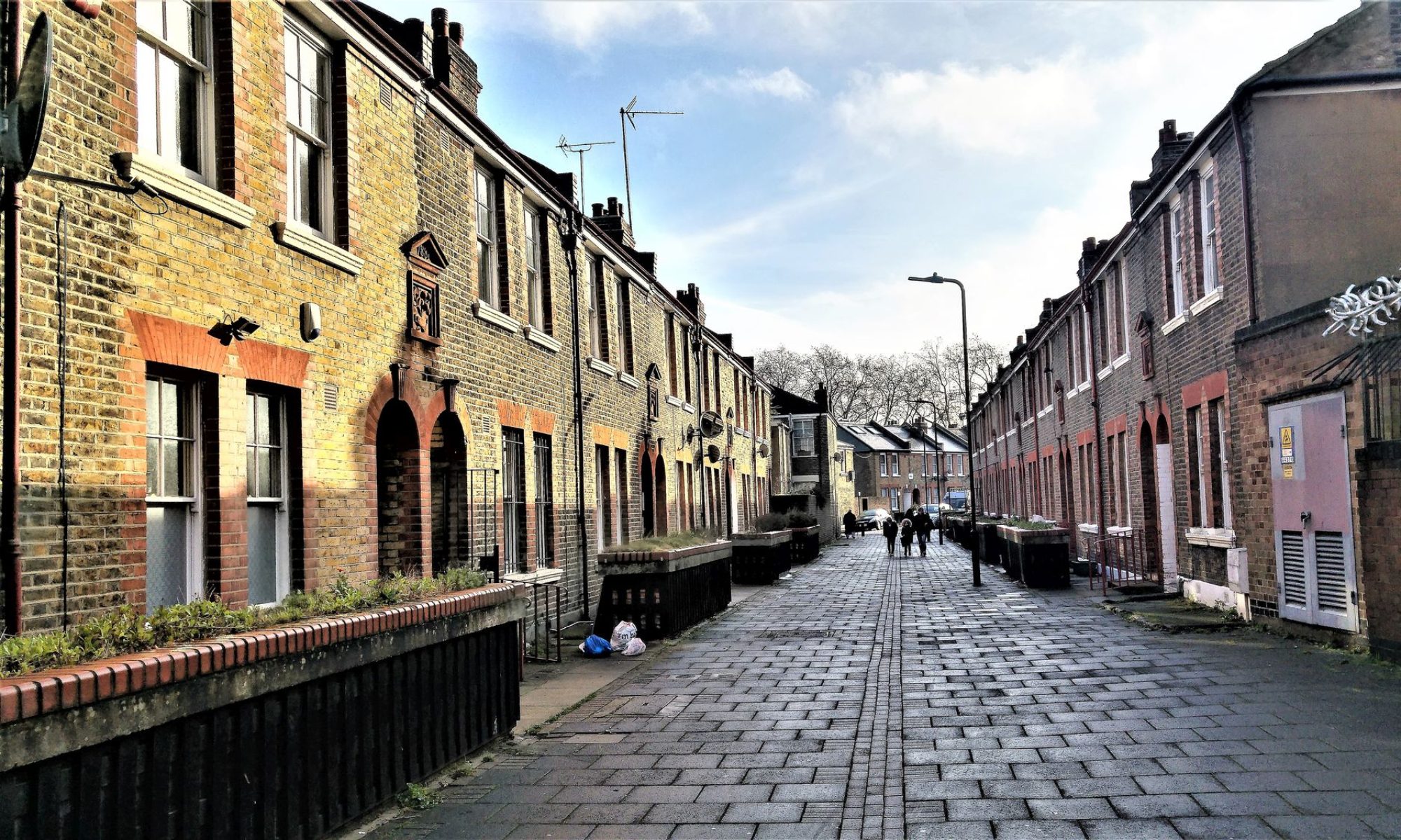
Sandringham Road is opposite my flat and goes up to Dalston, where it stops. Along the way there are historical and older parts, and the council buildings – houses mostly but some flats. It’s residential until you reach the top, where there are a few cafes and you are facing the Rio Cinema.

St Mark’s Rise is an interesting point along Sandringham Road. Its name is taken from the very large church at the corner, St Mark’s.
From Wikipedia – St. Mark’s Church: St. Mark’s is a large Victorian church primarily built in the period 1864–66 to a design by Chester Cheston. It is reputedly the largest parish church in London, larger than Southwark Cathedral, capable of hosting congregations of 1800-2000 people[12] and its great size has earned it the nickname, the “Cathedral of the East End””. The residential area around the church is also of high architectural quality and has accordingly been designated the “St. Mark’s Conservation Area”.
This seems to be another spot where there’s a lot to be learned, just a couple of minutes’ walk away.


Every time I take a walk and then blog, there’s a staggering amount of information and history attached to the streets I’ve casually walked along. I don’t have the time or disposition to check it all out.
Sandringham Road has a notorious reputation of being ‘The Frontline.’ There are videos at https://hackneyhistory.wordpress.com/2011/03/28/sandringham-road-e8-1983/ about the goings-on. We still see havoc outside sometimes but the times depicted in the video are gone. ‘Frontline was that radical political edge that talks between the black and white world. That’s where you feel safer from the police and the moral majority, but it’s also a place of real cultural activity.’ This is where the first black businesses are. And the drugs.
These days the population is mixed, perhaps a little more black, with Casablanca Caribbean restaurant at our end and Survivor and All Nations restaurants at the top. Street life can be ‘vibrant.’
Part of this landscape is the brightly painted house (number 81) on the north side of St Mark’s church. Leonard “Lennie” Lee painted it. He’s from South Africa but studied at Oxford. He is one of “the original East London artists and curators” and he painted his house in the 80s. https://www.ahackneyautobiography.org.uk/trails/food-and-frontline/8 has an interesting take on reactions to the changing community – in this case, Jewish to Caribbean – and one that sounds only too familiar. The Frontline had such historical importance…and I’m looking at the road right now through the leaves of the tree in front of our home.

Amazing how much there is on just this one corner but I walked on towards the high street, Kingsland Road.

The Rio is an iconic building as you reach the top of Sandringham Road. The original building was an auctioneer’s shop. The owner Clara Ludski converted it into one of London’s very first cinemas in 1909, and called it the Kingsland Palace of Animated Pictures. After the purchase of some adjoining buildings, construction began in 1913, and the Kingsland Empire opened in 1915. The Bromige Art Deco interior and exterior was restored in 1997, and the building became Grade II listed by English Heritage in 1999. Krish and I like to go here since it’s still mostly a one-screen cinema (there’s a basement screening room, added recently) with plenty of stretching room, rarely having many audience members when we go.


Today I didn’t go into Ridley Road Market. They are restricting people from entering. That will be for another day. My aunt has memories of it being a Jewish market but these days it’s Afro Caribbean for the most part. When we first moved to Hackney, there was a bagel shop at the Kingsland Road end, and at the Turkish Food Centre there’s a star of David symbol – something else to look into – but mostly these days it’s a mixed market focusing on the black population’s tastes. The market dates from the early 1880s, like much of the more modern area. It’s been the scene of many interesting events, such as the fascist marches of 1949 and 1962.
Rough times. No more, though, or not lately!


As usual, an almost overwhelming amount of information if you dig for it. For me, and for most of my neighbours, it’s just a local walk to the shops.
To get rid of place names on Google Maps, there are two options that I know of. You can go to mymaps.google.com and create a new map, choosing the “simple atlas” option. It looks a little different, but shows only street names and train stations. If you’re using the regular Google Maps for searching and browsing, click on the three horizontal lines in the upper left corner and when you click on satellite view you can toggle the labels on and off. The default is “on” and it will revert to that if you leave and come back to your view. It only works on satellite view for some reason.
Forgot to thank you for this comment, John. I’ve yet to try it out but I will.